


Hurricane season for the Gulf Coast runs June 1 through November 30, and the official season dates and historical peak fall between mid-August and mid-October, with the statistical high point landing around September 10. NOAA’s 2026 outlook leans toward a below-normal season for the Atlantic basin, but that number doesn’t tell you whether a storm hits your stretch of coastline. Preparing now still matters more than the seasonal forecast itself.
TL;DR:
- The peak danger of hurricanes along the Gulf Coast occurs between mid-August and mid-October, with the most active day around September 10.
- Storm surge, not wind speed, causes most hurricane-related fatalities and can be dangerous even from weak or slow-moving storms.
- Preparing your home, vehicle, and supplies early, before hurricane watches are issued, greatly improves safety and reduces damage risks.
- Local evacuation zones and routes vary by county, so residents should know their specific plans well in advance to avoid last-minute confusion.
- The 2026 season is expected to have below-normal overall activity, but a single storm can still cause extensive damage regardless of seasonal forecasts.
Table of Contents
- What the official season window means for the Gulf Coast
- Why mid-August through mid-October is the real danger zone
- Making sense of NOAA’s below-normal outlook for 2026
- The five hazards that actually cause Gulf Coast damage
- Understanding watches, warnings, and when to act
- Building your preparedness timeline before a storm forms
- How risk differs across Florida, Alabama, Mississippi, Louisiana, and Texas
- Simple steps for travelers and hosts before you book
- Notable Gulf Coast storms and what they left behind
- Knowing your evacuation route before you need it
- What’s changing about hurricane risk on the Gulf Coast
- How Gulf Coast communities are building storm resilience
- Securing your home, boat, and vehicle before landfall
- Staying safe in the days after a hurricane passes
- Why I check the forecast every single June
- Booking Gulf Coast rentals with your safety in mind
- Where to follow official forecasts and alerts
- Sources
- FAQ
What the official season window means for the Gulf Coast
NOAA marks June 1 through November 30 as the Atlantic hurricane season because that window captures the vast majority of tropical activity across the basin, which includes the Gulf of Mexico, the Caribbean, and the open Atlantic. Warm ocean water, low wind shear, and moisture in the atmosphere all come together during these months to create the conditions tropical systems need.
For Gulf Coast residents, the dates aren’t just a calendar formality. A named storm can form and strengthen quickly in the warm, shallow waters of the Gulf, sometimes giving coastal communities less lead time than storms that track across the open Atlantic for days first. Understanding that the entire six-month window carries risk, not just the headline months, keeps preparation from becoming an afterthought until a storm is already spinning offshore.
Why mid-August through mid-October is the real danger zone
Activity doesn’t spread evenly across the season. The bulk of named storms and hurricanes cluster in August, September, and October, a stretch climatologists refer to as ASO, and the single most active day historically falls around September 10. Ocean temperatures peak during these months after a full summer of solar heating, and the broader atmospheric patterns that suppress storm formation earlier in the year tend to relax.
That timing has practical value. If you’re planning Gulf Coast travel, weighing outdoor construction schedules, or deciding when to double-check your insurance paperwork, mid-August through mid-October deserves your closest attention. Early June and late November carry real but comparatively lower risk. Travelers who want beach time with less storm anxiety often lean toward the shoulder months, a tradeoff worth weighing against the best times to visit Gulf Shores if flexibility is on your side.

Making sense of NOAA’s below-normal outlook for 2026
NOAA’s 2026 Atlantic outlook points to a higher chance of below-normal activity basin-wide, expressed as a probabilistic range rather than a fixed storm count. That distinction matters. A below-normal seasonal outlook describes the likely total number of storms across the whole Atlantic, not whether any particular storm makes landfall on the Gulf Coast.
NOAA itself is direct about this limitation: seasonal outlooks are not landfall forecasts. Some of the most damaging Gulf Coast hurricanes on record occurred in years with otherwise quiet or average seasonal totals, which is exactly why the agency emphasizes that it only takes one storm to devastate a community regardless of how the overall season shapes up. Treat the outlook as useful context for the six months ahead, not as a reason to skip your preparation checklist.
The five hazards that actually cause Gulf Coast damage
Wind speed gets the headlines, but it isn’t what kills most people in a hurricane. Storm surge is the leading cause of hurricane-related deaths in the United States, and it behaves independently of the storm’s category rating. A slow-moving Category 1 storm over a shallow continental shelf, which describes much of the Gulf, can push a more dangerous surge than a fast-moving Category 3 elsewhere.
Six inches of fast-moving water can knock an adult off their feet, and two feet can float a car, according to the National Weather Service; in the most extreme cases, storm tides have exceeded 20 feet. That single fact should shape how seriously you take evacuation orders tied to surge, even when the wind forecast sounds mild.
Beyond surge, four other hazards deserve attention:
- Inland flooding from heavy rainfall can affect areas far from the coast and often causes more prolonged damage than the initial landfall.
- Damaging winds near the storm’s center bring the structural risk most people associate with hurricanes.
- Rip currents intensify along Gulf beaches days before and after a storm passes, even under otherwise sunny skies.
- Tornadoes frequently spin up in a hurricane’s outer bands, often with little warning.
Understanding watches, warnings, and when to act
A Hurricane Watch means hurricane conditions are possible within 48 hours; a Hurricane Warning means those conditions, sustained winds of 74 miles per hour or higher, are expected within 36 hours. The gap between the two matters because it determines how much time you realistically have left.
- At Watch stage (48 hours out): finalize your evacuation plan, fuel your vehicle, and pack your emergency supplies.
- At Warning stage (36 hours out): evacuate immediately if local officials order it, or shelter in a safe interior room if you’re staying.
- Throughout both stages: monitor your local National Weather Service office and enable Wireless Emergency Alerts on your phone for real-time updates.
Local NWS offices and the National Hurricane Center issue the surge maps and localized guidance that a national forecast can’t capture, so lean on those sources once a storm enters the Gulf.
Building your preparedness timeline before a storm forms
Waiting until a storm appears on the map is the most common preparedness mistake. Flood insurance typically carries a 30-day waiting period, so buying a policy after a Hurricane Watch is issued usually means you’re uninsured for that exact storm. FEMA’s National Flood Insurance Program confirms the same standard waiting period, with only limited exceptions you shouldn’t count on.
Pro Tip: Review your homeowner’s and flood policies every spring, before the season opens on June 1, so you’re never scrambling to find your coverage limits during an active Watch.
Your seasonal checklist should include:
- Buy or renew flood insurance well before June 1, given the standard 30-day waiting period.
- Assemble supplies for at least three to seven days, including water, medications, and cash, since ATMs and card readers may go down.
- Charge backup batteries and power banks, and know your community’s evacuation zone before a storm forces the question.
- Photograph your home’s exterior and valuables for insurance documentation, and secure loose items in your yard.
If you’re traveling to the Gulf Coast during the season, ask your rental host directly about their evacuation and refund policy, and keep the property’s rental agreement terms and local contact numbers saved on your phone rather than buried in an email. A travel insurance policy purchased early in your planning, rather than after a storm is named, is far more likely to actually cover a hurricane-related cancellation.
How risk differs across Florida, Alabama, Mississippi, Louisiana, and Texas
Florida’s long coastline and heavy tourist traffic mean rip currents and beach closures affect more visitors than in any other Gulf state. Alabama and Mississippi concentrate much of their population on barrier islands and narrow coastal strips, which makes evacuation timing especially important there. Louisiana’s low elevation and delta geography amplify both surge and inland flood risk, often in the same storm. Texas spans a wide coastal shelf and has seen major flood events well inland from where a storm actually made landfall, a reminder that rainfall risk doesn’t stop at the beach.
Simple steps for travelers and hosts before you book
Ask your host directly about their evacuation and refund policy before you pay a deposit, and save their phone number rather than relying only on app messages. Direct-book marketplaces tend to connect you with owners faster during active weather than listings routed through a call center, which matters when you need a same-day answer.
Notable Gulf Coast storms and what they left behind
The Gulf Coast has absorbed some of the country’s most consequential hurricanes, and the pattern across those storms is consistent: the worst damage rarely comes from wind alone. Storms that stalled over the coast or pushed unusually large surge into low-lying communities caused damage that outlasted the storm itself by years, in some cases reshaping entire neighborhoods and rewriting local building codes.
The lesson embedded in that history is that storm surge and inland flooding, not the category number on the news, determine how bad a particular hurricane turns out to be for a particular community. A storm that weakens right before landfall can still push a lethal surge if it’s large and slow-moving, and a storm that stays offshore can still flood inland towns if it drags moisture across the region for days. Coastal counties across Florida, Alabama, Mississippi, Louisiana, and Texas have each experienced this firsthand at different points, which is part of why local emergency officials evaluate every storm on its specific track and structure rather than assuming a lower category means a lower threat.
If you own or manage property in a Gulf Coast community that has weathered a major storm before, your neighbors and local emergency management office are often your best source of storm-specific history: which streets flood first, which shelters fill up fastest, and which evacuation routes back up earliest. That local knowledge doesn’t show up in a national forecast.
Knowing your evacuation route before you need it
Every coastal county along the Gulf maintains its own evacuation zone maps and designated routes, and local National Weather Service offices tailor surge and evacuation guidance to those specific communities rather than issuing one generic map for the whole coast. Find your zone before hurricane season starts, not after a Watch is issued, since evacuation zones are usually numbered or lettered and posted on your county emergency management website.
Local emergency managers often plan for a storm one category stronger than currently forecast, building in a margin of safety that accounts for last-minute strengthening. That’s worth remembering if you’re tempted to wait out an evacuation order because the forecast wind speed sounds manageable: the order is based on a wider set of risk factors, including surge modeling and road capacity, not just wind.
If you’re renting a vacation home rather than staying in a permanent residence, ask your host in advance whether the property sits inside a designated evacuation zone and what backup routes exist if the main road floods first. Coastal roads in Louisiana and parts of Florida are particularly prone to early flooding during surge events, sometimes hours before the storm’s core arrives. Keep a paper map or offline map app as a backup, since cell towers and GPS services can go down during severe weather right when you need directions most.
County emergency management offices, not just the National Hurricane Center, are your best source for the specific shelter locations, contraflow lane schedules, and pet-friendly evacuation options available in your area.
What’s changing about hurricane risk on the Gulf Coast
Warmer Gulf water gives storms more fuel to intensify quickly, sometimes within the final day or two before landfall, which shortens the window communities have to prepare once a storm’s true strength becomes clear. Rising sea levels also mean that a given storm surge height now reaches farther inland than the same surge would have decades ago, compounding flood risk in low-lying Gulf communities.
None of this changes the official season dates or the ASO peak pattern that NOAA has documented over decades of climatology, but it does mean that older assumptions about how a storm will behave near the coast deserve a second look. A storm that seems moderate at 48 hours out can still strengthen meaningfully before the Warning stage, which is part of why officials increasingly stress reacting to forecast trends rather than a single snapshot number.
Coastal development patterns add another layer. More homes and infrastructure now sit in surge-prone zones than in past decades, simply because Gulf Coast communities have grown. That growth raises the stakes of any given storm even if storm frequency itself doesn’t change much from year to year, which is one reason local and state governments continue investing in resilience measures rather than relying on historical storm counts alone.
How Gulf Coast communities are building storm resilience
Many Gulf Coast counties have updated building codes over the past two decades to require stronger roof connections, impact-resistant windows, and elevated foundations in flood-prone zones, changes driven directly by lessons from past storms. Elevated construction is now standard in much of coastal Louisiana and parts of the Florida Panhandle, reducing flood damage even when surge reaches a property.
Beyond individual buildings, several Gulf states have invested in restored wetlands and barrier islands, which act as natural buffers that slow surge before it reaches populated areas. Levee systems around New Orleans and other low-lying communities have also seen substantial upgrades since past major storms, though officials continue to stress that no levee system eliminates flood risk entirely.
Emergency communication has improved as well. Wireless Emergency Alerts, county-level text alert systems, and expanded shelter networks all reduce the lag between a warning being issued and residents receiving it. None of these measures make any Gulf Coast community immune to a major hurricane, but together they represent a meaningful shift toward communities that recover faster and lose less when a storm does arrive.
Securing your home, boat, and vehicle before landfall
Start outside. Bring in or secure anything that could become a projectile in high wind: patio furniture, potted plants, grills, and trash cans. If you have hurricane shutters, install them once a Watch is issued rather than waiting for the Warning, since installation gets harder and more dangerous as wind picks up.

For your vehicle, keep the gas tank full once hurricane season begins in earnest, since gas station lines and outages are common in the days before a storm. If you’re not evacuating and your area isn’t under surge risk, move vehicles to higher ground or a garage; if you are evacuating, take your vehicle with you rather than leaving it parked in a flood-prone area.
Boat owners should move vessels to a marina with hurricane-rated tie-downs well before a Watch is issued, or trailer the boat inland if time allows. Waiting until a Warning is issued often means marinas are already full or inaccessible.
Inside the home, unplug major appliances and electronics to protect against power surges, and move valuables and important documents to the highest floor or a waterproof container. If your property sits in a flood zone, consider sandbagging exterior doors and shutting off utilities if instructed by local officials. Photograph every room before you leave, both for insurance purposes and to document the property’s condition, a step vacation rental hosts in particular should never skip given how often storm damage claims hinge on before-and-after evidence.
Staying safe in the days after a hurricane passes
The period right after a hurricane leaves the area is when a surprising share of storm-related injuries and illnesses actually occur, often from hazards people underestimate once the wind dies down. Floodwater should always be treated as contaminated, since it frequently carries sewage, chemicals, and debris; avoid wading through it whenever possible, and wash any exposed skin thoroughly if contact happens.
Power outages bring their own risks. Never run a generator inside a garage or enclosed space, since carbon monoxide builds up quickly and can’t be smelled or seen. Keep refrigerator and freezer doors closed as much as possible to preserve food safely, and if power stays off longer than four hours, plan to discard perishable items rather than risk foodborne illness.
Downed power lines should be treated as live until a utility crew confirms otherwise, and standing water near any electrical source is particularly dangerous. If you’re returning to a rental property or your own home after an evacuation, check for structural damage before entering, including cracks in the foundation or a compromised roofline, and use a flashlight rather than a candle if the power is still out, since gas leaks can go undetected in the dark.
Boil-water advisories are common after major storms disrupt municipal water treatment, so check with local officials before drinking tap water, and keep bottled water on hand until the advisory lifts.
Why I check the forecast every single June
Every season, I remind myself that a below-normal forecast is not a promise. The Gulf Coast communities that fare best are the ones that prepare in May, not the ones that scramble once a storm has a name.
— Tayler
Booking Gulf Coast rentals with your safety in mind
Traveling to the Gulf Coast during hurricane season doesn’t have to mean guesswork about who to call if a storm approaches. Emerald Coast By Owner connects you directly with the property owner, so you can ask about evacuation plans, refund terms, and local contacts before you ever pay a deposit, without a call center standing between you and a real answer.
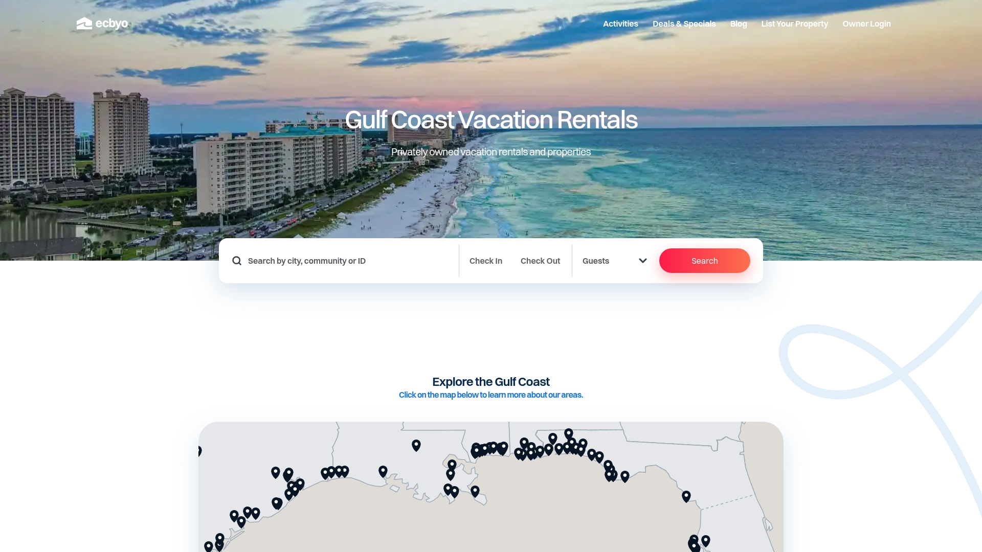
- Search Florida, Alabama, Mississippi, Louisiana, or Texas rentals by owner, with no added traveler service fees.
- Message owners directly to confirm their storm policy before booking.
- Browse current deals and specials while planning your shoulder-season trip.
Property owners looking to list a Gulf Coast rental and communicate storm policies clearly to guests can start with an ECBYO subscription for $499 per year. Start your search at Emeraldcoastbyowner.
Where to follow official forecasts and alerts
Follow the National Hurricane Center, your local National Weather Service office, county emergency management, and Ready for preparedness guidance.
Sources
FAQ
What month has the most hurricanes in the Gulf of America?
September is historically the most active month, with the single-day statistical peak falling around September 10. Activity generally concentrates across August, September, and October, a stretch known as ASO.
What are the hurricane predictions for the Gulf Coast in 2026?
NOAA’s 2026 outlook points to a higher chance of a below-normal Atlantic season basin-wide. That outlook describes overall basin activity, not whether a specific storm will strike the Gulf Coast, since NOAA is explicit that seasonal outlooks are not landfall forecasts.
What month is worst for hurricanes?
Mid-August through mid-October is considered the most dangerous stretch of the season, with September the historical peak. Warm ocean temperatures and favorable atmospheric patterns during these months allow storms to form and strengthen more easily.
What are the worst months to visit Florida for hurricanes?
Late August through early October carry the highest hurricane risk for Florida travel, based on the same ASO climatology pattern that applies across the Gulf Coast. Travelers who prefer lower storm risk often choose late spring or the tail end of the season, and comparing Gulf Shores travel timing can help with similar decisions elsewhere on the coast.
Should I buy flood insurance right before a storm approaches?
No, flood insurance typically carries a 30-day waiting period before coverage takes effect, so buying it once a storm is already forecast usually won’t protect you from that specific event. Purchase or review your policy well before hurricane season opens on June 1.
Recommended
- Save on Gulf Coast Shoulder Season: Apr to May or Sep to Oct
- Gulf Coast National Parks and Beaches: Top Picks for Nature Lovers
- October Gulf Coast Beach Explained: Your Fall Travel Guide

About the Author
Tayler Jaeger of the Emerald Coast by Owner Editorial Team creates destination guides, vacation-planning resources, and local travel content focused exclusively on Gulf Coast vacation rentals.
Our team researches beach communities, vacation rental trends, family travel planning, local attractions, and direct-booking best practices across Florida, Alabama, Mississippi, Louisiana, and Texas. Every guide is written to help travelers make more informed booking decisions while avoiding unnecessary third-party guest service fees.
Since launching in 2016, Emerald Coast by Owner has helped connect travelers directly with verified vacation rental hosts across the Gulf Coast.
This article was reviewed for accuracy and updated using local destination research and current vacation rental market insights.


